Monsoon
AQI in Delhi ‘satisfactory’, heavy rains likley on Wednesday
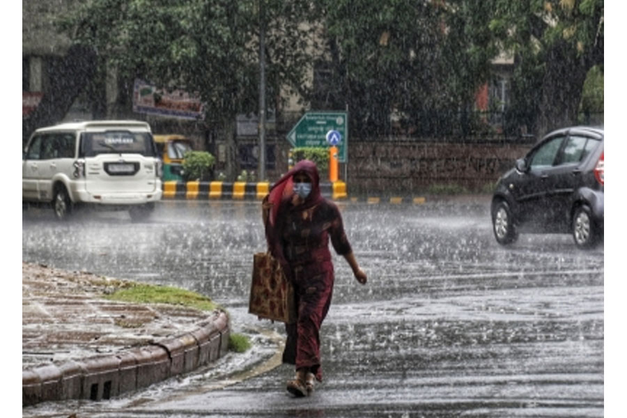
Even as Monday witnessed a sultry weather in the national capital, the rain from the previous day washed off much of the pollutants in the environment resulting in an overall ‘satisfactory’ air quality.
India Meteorological Department (IMD) forecast for Monday predicted generally cloudy sky with light rain. It has forecast moderate rain for Tuesday and heavy rain for Wednesday.
Not just Delhi, the IMD has predicted isolated rainfall activity over Punjab, Haryana, Chandigarh, Uttar Pradesh and Rajasthan during next 24 hours and scattered to widespread rain with isolated thunderstorm/lightning over the region between July 5 and 8.
On Sunday, few places in Delhi such as Pitampura, Delhi University and Ridge (north Delhi) registered a rainfall above 20 mm while in rest of the areas, it was either ‘traces’ or fairly negligible rainfall.
“AQI today indicates ‘satisfactory’ air quality with dust (particle size more than 2.5 micrometer) contribution at approximately 57 per cent to PM10. For the next three days, i.e., till July 7, peak wind speed is likely to be about 15-20 kmph causing moderate dispersion and AQI is likely to be within asatisfactory’ due to expected light rain spells,” the System of Air Quality and Weather Forecasting and Research (SAFAR), under the Indian Institute of Tropical Meteorology (IITM), Pune, said.
Moderate temperature ranging around 35-36 degrees Celsius and mixing layer height maintains moderate ventilation, it said.
It also pointed out that currently there is negligible impact of stubble burning and external dust intrusion.
An air quality index between 0 to 50 is considered ‘good’; 51 and 100 ‘satisfactory’; 101 and 200 ‘moderate’; 201 and 300 ‘poor’; 301 and 400 ‘very poor’ and an AQI over 401 is considered ‘severe’. While most of the stations in central and south Delhi showed asatisfactory’ AQI, those along the border nearer to Haryana showed amoderatea� AQI taking the overall air quality to asatisfactory’.
At 2.00 p.m, the AQI at Anand Vihar in east Delhi was 125, Ashok Vihar in north Delhi was 121, Jahangirpuri in northeast Delhi 128, Dwarka sec 8 in west Delhi 117, Pusa in west Delhi 111, Lodhi Road in central Delhi 86, IGI Airport in southwest Delhi 108, R K Puram in south Delhi 81, `Aurobindo Marg in south Delhi 67, and Siri Fort in south Delhi 85, according to Central Pollution Control Board (CPCB).


Maharashtra
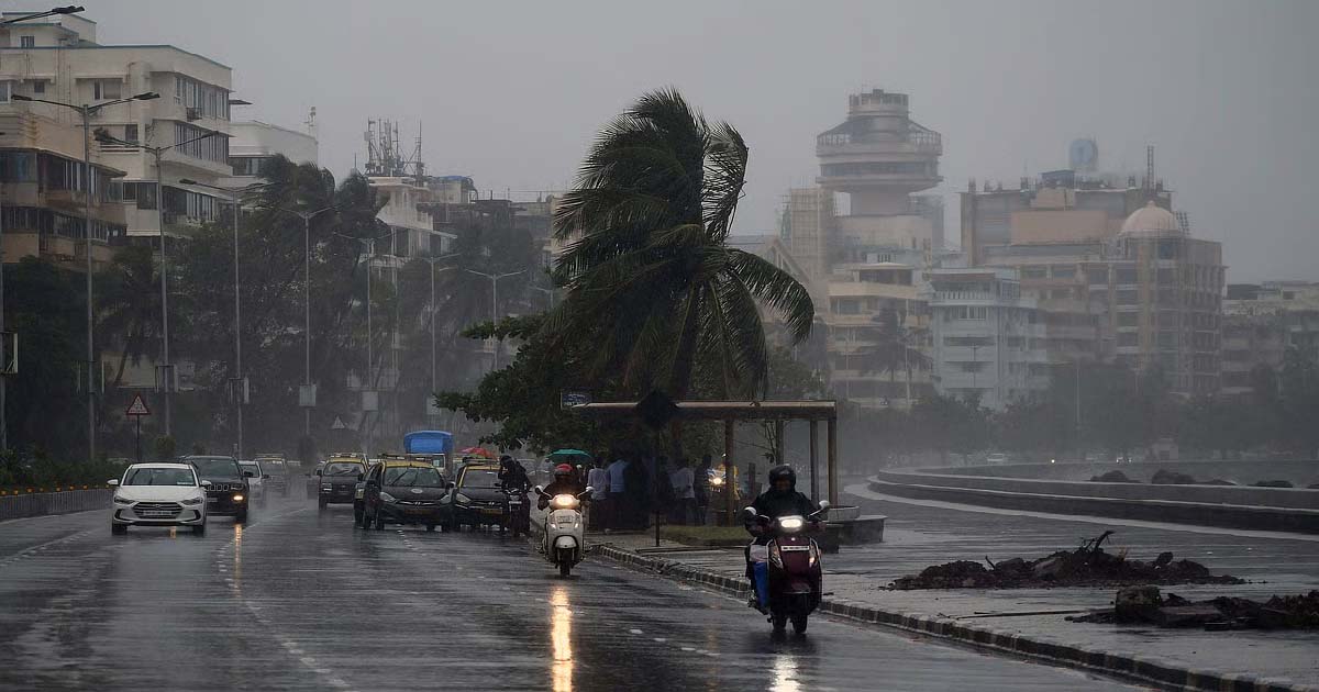
Mumbai Weather Update: Heavy Rain Alert Issued For City & Konkan; IMD Issues Yellow Alert

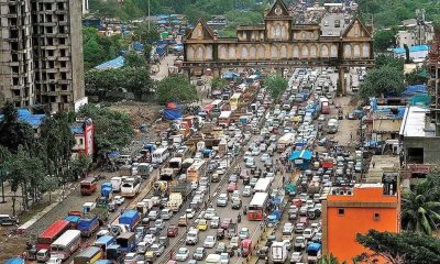
Mumbai: Mumbai began the week under heavy cloud cover on Monday morning, with the India Meteorological Department (IMD) issuing a yellow alert for the city and its surrounding regions. After intermittent but intense showers over the past few days, weather officials have forecast widespread rainfall across Mumbai, Thane, Navi Mumbai and other parts of the Konkan belt throughout the day.
According to the IMD, heavy to very heavy rainfall is expected in several districts, including Mumbai, Thane, Navi Mumbai, Raigad, Ratnagiri, Palghar and Sindhudurg. The alert indicates the possibility of disruptions due to waterlogging in low-lying areas, traffic delays and interruptions to suburban rail services. Maximum and minimum temperatures in Mumbai are likely to hover around 29 and 25 degrees Celsius, respectively, keeping conditions cool but humid.
In Thane and Navi Mumbai, heavy showers are predicted to persist through the day. Heavy rain showers may lead to disruptions on the Central & Harbour Railway routes, which are often affected during prolonged spells of monsoon rain. Authorities have urged residents to exercise caution while stepping out, especially during peak rainfall hours.
Palghar district, which has already been receiving continuous rainfall over the past two to three days, remains under a yellow alert. While some parts are likely to see moderate rain, others may experience intense downpours accompanied by strong winds. The IMD has also cautioned about damp and humid conditions prevailing across the region.
The southern Konkan districts of Raigad, Ratnagiri and Sindhudurg are also bracing for another day of heavy rain. These areas, which have been dealing with waterlogging and disruptions to daily life over the past week, are expected to face similar challenges again.
Maharashtra
Mumbai Weather Update: City To See Light To Moderate Showers With Cloudy Skies Today; No Rain Alert For Next Few Days
WETHER
Mumbai: Mumbai woke up to scattered light rain showers on Friday morning. Though the city received rains in the early hours, the weather department has not issued any rain alert for today.
According to the IMD, the city would see an overcast sky with intermittent light showers, while a few areas may receive moderate spells. However, there is no forecast of heavy or widespread rainfall. Maximum temperature is likely to touch 28°C, while the minimum may settle at 25°C. Winds near the coast are expected to remain light to moderate.
Neighbouring Thane and Navi Mumbai are set to experience similar conditions. Residents can expect drizzle to moderate showers through the day, with no significant rainfall activity on the radar. Cloudy skies will persist, and the weather is likely to remain humid. Daytime temperatures are expected to hover around 28°C, while the night temperature will remain between 24°C and 25°C.
In Palghar, skies will stay overcast, and the rainfall pattern is expected to be uneven. While some pockets may only see light drizzle, others could receive moderate spells. The weather confirmed that no weather alert has been issued for the district. Maximum temperature is forecast at 28°C and minimum at 25°C, with conditions expected to remain damp and humid.
Further down the Konkan coast, Raigad, Ratnagiri and Sindhudurg districts, which witnessed heavy rain over the past few days, are also expected to see a decline in intensity. IMD officials said only light to moderate showers are likely, accompanied by cloudy weather.
The department clarified that there is no threat of heavy rain on Friday. Coastal winds in these regions may blow slightly stronger than in Mumbai and Thane. Daytime temperature could reach 29°C, while the minimum will remain around 25°C.
Maharashtra
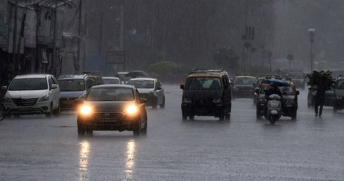
Mumbai Weather Update: Heavy Rains To Lash City Today, IMD Issues Yellow Alert For Sept 5-6
WETHER
Mumbai: Mumbaikars woke up on Friday to a grey sky and yet another spell of rain-soaked morning showers, as the monsoon continued its firm grip over the city. The India Meteorological Department (IMD) issued a yellow alert for Mumbai, warning of heavy rainfall through the day on September 5 and 6. The prediction has kept civic authorities and residents on watch, with the city bracing for another round of waterlogging and traffic snarls.
According to the IMD’s forecast, the next 48 hours are expected to bring intermittent spells of heavy rain across Mumbai and its suburbs. Friday and Saturday will see generally cloudy skies with intense downpours, accompanied by humid and sticky weather. Daytime temperatures are likely to hover between 30–31 degrees Celsius, while the minimum will remain close to 24 degrees, offering little comfort to residents battling the damp conditions.
The rains, however, are not expected to last with the same intensity throughout the coming week. From September 7, Mumbai may finally witness a gradual dip in rainfall activity. The IMD has forecast moderate showers on Sunday and Monday, which will bring some relief to commuters. By September 9 and 10, the city is likely to experience light rainfall, and no weather warnings have been issued for these days, hinting at a much-needed break from the heavy monsoon spell.
Meanwhile, across Maharashtra, the weather department predicted varying rainfall intensity. On September 5, the monsoon remains active over the state. Light to moderate rain is expected in several districts, while central Maharashtra may experience heavy to very heavy rainfall in isolated pockets. Northern coastal Maharashtra is also on alert, with winds forecast to blow at speeds of nearly 50 kmph, raising concerns for fishermen and coastal residents.
In the Konkan region, the situation remains mixed. Raigad district has been placed under an orange alert with the possibility of very heavy rains in some parts. Meanwhile, Ratnagiri and Sindhudurg, on the other hand, are under a yellow alert, indicating heavy rain at isolated places but not of the same intensity as Raigad. Temperature-wise, Konkan is recording a maximum of around 29.4 degrees Celsius and a minimum of 25 degrees, reflecting the cloudy and damp weather conditions.

Ameer Sunni Dawat-e-Islami Maulana Mohammad. Shakir Noori is once again included in the list of the 500 most influential Muslims of the year 2026.

‘34 massacres took place in between 1990-2005’: HM Amit Shah lambasts RJD

‘Onboard LTTE-ISI Operatives’: IndiGo Flight From Jeddah To Hyderabad Diverted To Mumbai After Receiving ‘Human Bomb’ Threat

‘Run for Unity’ marathon organized in Malegaon on the occasion of 150th birth anniversary of Sardar Vallabhbhai Patel, large number of youth participated

Gujarat: Applications for selection of State Haj Inspectors for Haj 2026 open till Nov 3

Mumbai: Nurse Reports Theft Of ₹56,000 Ring And Cash From Hospital Locker; FIR Registered In Bandra

Amitabh Bachchan reflects on changing times and fading memories

‘Only time will tell, don’t write off champion players’: Shastri, Ponting on 2027 WC prospects of Rohit, Kohli

Khushi Mukherjee: Ex-Splitsvilla Contestant & Actress Throws Firecrackers On Road After Being Involved In Verbal Spat Over Damage To Her Car In Lokhandwala

Aurangabad railway station renamed to Chhatrapati Sambhajinagar station
-

 Crime3 years ago
Class 10 student jumps to death in Jaipur
-

 Maharashtra1 year ago
Mumbai Local Train Update: Central Railway’s New Timetable Comes Into Effect; Check Full List Of Revised Timings & Stations
-
 Maharashtra1 year ago
Mumbai To Go Toll-Free Tonight! Maharashtra Govt Announces Complete Toll Waiver For Light Motor Vehicles At All 5 Entry Points Of City
-

 Maharashtra1 year ago
False photo of Imtiaz Jaleel’s rally, exposing the fooling conspiracy
-
 National News1 year ago
Ministry of Railways rolls out Special Drive 4.0 with focus on digitisation, cleanliness, inclusiveness and grievance redressal
-
 Maharashtra12 months ago
Maharashtra Elections 2024: Mumbai Metro & BEST Services Extended Till Midnight On Voting Day
-

 National News1 year ago
J&K: 4 Jawans Killed, 28 Injured After Bus Carrying BSF Personnel For Poll Duty Falls Into Gorge In Budgam; Terrifying Visuals Surface
-

 Crime1 year ago
Baba Siddique Murder: Mumbai Police Unable To Get Lawrence Bishnoi Custody Due To Home Ministry Order, Says Report