weather
Cyclone Biperjoy: IMD Says Low-Pressure Area To Intensify Over Arabian Sea In Next 24 Hours
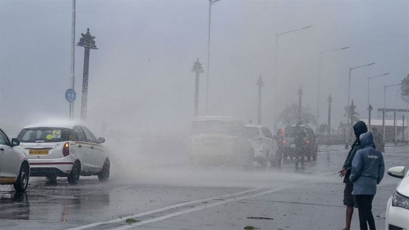
In its latest weather update on Monday, the India Meteorological Department (IMD) announced the presence of a cyclonic circulation over the southeast Arabian Sea, extending up to middle tropospheric levels. As a result of this weather system, a low-pressure area is expected to develop within the next 24 hours over the same region. The IMD further predicted that this low-pressure area will move in a northward direction and potentially intensify into a depression southeast and adjoining east-central Arabian Sea within the subsequent 48 hours.
Cyclone Name and Possible Track
If the low-pressure area consolidates into a cyclonic storm, it will be named Cyclone Biperjoy, as designated by Bangladesh. The exact track of the cyclone remains uncertain at this point. While some models suggest a northerly movement along the West Coast of India, others indicate initial northward progression followed by a re-curvature toward Oman and Yemen, according to private weather forecaster Skymet.
Impact on West Coast: Intensified Rainfall and Monsoon Arrival
Skymet’s forecast indicates that rain activity will intensify significantly along the West Coast of India, spanning from Kerala to Maharashtra. The cyclone’s presence is expected to facilitate the timely arrival of the monsoon current in Mumbai. Consequently, rough to very rough sea conditions are anticipated along the Karnataka and Maharashtra coasts from June 8 to 10, and over the Gujarat coast from June 9 to 12.
Sea Conditions and Coastal Alert
The intensified cyclonic conditions in the Arabian Sea will lead to rough seas along the Karnataka, Maharashtra, and Gujarat coasts. Residents and authorities in these regions are advised to exercise caution and adhere to safety measures. Fishermen are urged to avoid venturing into the sea during the specified period to ensure their safety.
National News
Mumbai Weather Update: City Wakes Up To Thick Smog, Unhealthy Air Quality; Overall AQI Recorded At 263, Colaba & Deonar Worst Hit
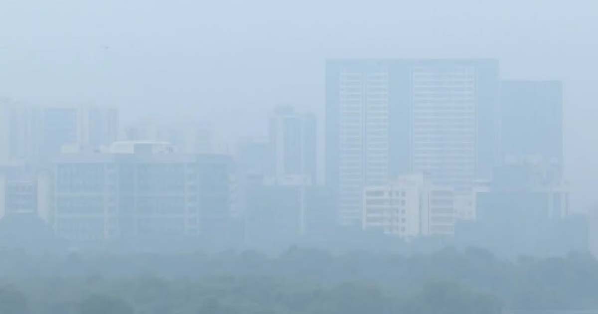
Mumbai: Mumbai woke up on Friday morning to clear skies overshadowed by a thick layer of smog that blurred its iconic skyline. Several areas across the city, including Bandra-Kurla Complex (BKC), were shrouded in dense haze, marking a sharp decline in air quality after weeks of improvement.
According to the India Meteorological Department (IMD), while the city will experience clear skies through the day, visibility was significantly reduced in the early hours due to smog. Daytime temperatures are expected to hover around 32°C, with the minimum settling near 20°C, conditions described as pleasant for early November.
Just days ago, Mumbai enjoyed cleaner air following a brief but intense spell of rain that helped wash away pollutants and brought temporary relief from humidity. However, the improvement was short-lived, as the city’s Air Quality Index (AQI) plunged to alarming levels within a matter of days.
Fresh data from AQI.in released on Friday morning showed Mumbai’s overall AQI at 263, placing it in the unhealthy category. The figure marks a steep fall from the good to moderate readings recorded earlier in the week. Residents from several areas reported hazy horizons and visibly poor air quality, with the city’s skyline appearing smudged even after sunrise.
Among the city’s monitoring stations, Parel-Bhoiwada recorded the highest AQI at 320, followed closely by Deonar (319) and Colaba (318). Other prominent localities such as Vile Parle West (313) and BKC (310) also reported AQI levels in the severe range, indicating dangerously high concentrations of particulate matter.
Relatively cleaner air was observed in a few western suburbs, with Kandivali East recording an AQI of 93, categorised as moderate. Meanwhile, Mankhurd (140), Borivali East (163), Bhandup West (173) and Malad West (173) all fell under the poor bracket, reflecting a widespread drop in air quality across the city.
As per AQI.in’s classification, readings between 0–50 are “Good,” 51–100 “Moderate,” 101–150 “Poor,” 151–200 “Unhealthy,” and anything above 200 is deemed “Severe” or “Hazardous.”
Maharashtra
Mumbai Weather Update: City Wakes Up To Clear Skies, Mild Breeze; Overall AQI Stays In Moderate Range At 78
wether
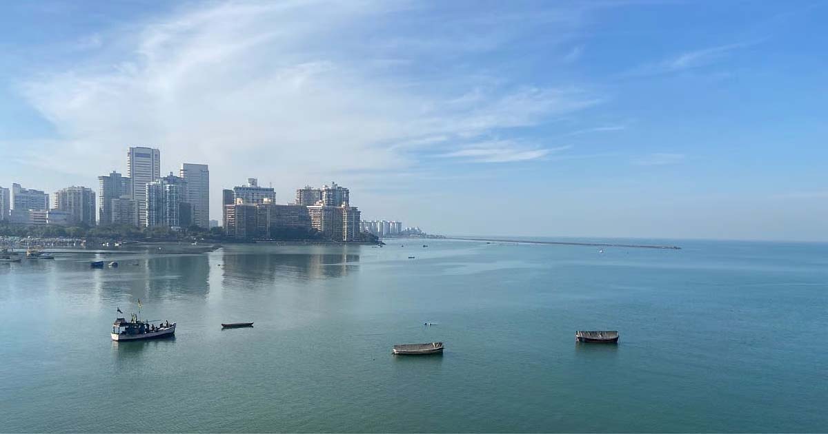
Mumbai: After weeks of unsettled weather and intermittent showers, the city finally woke up to clear skies and crisp air on Thursday, marking what appears to be the end of the monsoon season. For the past two days, no rainfall was recorded across Mumbai, signalling that the retreating monsoon clouds have made way for the onset of post-monsoon conditions.
According to the India Meteorological Department (IMD), the city is expected to experience clear skies through the day, with only a minimal chance of isolated light showers or thunderstorms in select pockets. Daytime temperatures are likely to hover around 33°C, while the minimum will settle near 23°C, conditions described as pleasant and comfortable for early November.
The recent spell of short but intense showers had not only brought temporary relief from humidity but also helped wash out accumulated pollutants, leading to an overall improvement in air quality. Prior to this, the withdrawal of monsoon winds had caused a spike in pollution levels due to stagnant air and increased vehicular emissions, resulting in a hazy skyline and reduced visibility.
Fresh data released by AQI.in on Thursday morning reflected this improvement. Mumbai’s overall Air Quality Index (AQI) stood at 78, placing it in the moderate category. While the figure marks a slight dip from the good air quality recorded earlier in the week, it still represents a substantial improvement compared to the smog-filled conditions observed after monsoon withdrawal.
Residents across various parts of the city reported clearer skylines and visibly better air. Among the city’s monitoring stations, Wadala Truck Terminal recorded the highest AQI reading at 92, followed by Parel-Bhoiwada (90) and Mulund West (88). Santacruz East and Bhandup West both registered an AQI of 87, keeping them within the moderate range.
Cleaner air was observed in several western suburbs, where Kandivali East recorded an AQI of 45, falling in the good category. Malad West (59), Powai (62), Jogeshwari (65), and Borivali East (67) were all categorised as moderate, suggesting a consistent improvement across the city’s landscape.
As per AQI.in’s classification, an index between 0–50 is considered “Good,” 51–100 “Moderate,” 101–150 “Poor,” 151–200 “Unhealthy,” and anything above 200 is deemed “Severe” or “Hazardous.”
National News
Mumbai Weather Update: Clear Skies Return As City Enjoys Fresh Air & Mild Breeze; AQI Slightly Deteriorates, Dips In Moderate Range At 81
wether
Mumbai: After weeks of fluctuating weather, Mumbai woke up to bright blue skies and crisp air on Wednesday, signalling a likely end to the monsoon spell. No rainfall was recorded anywhere majorly across the city on Tuesday, indicating that the rain clouds have finally retreated for the season.
According to the India Meteorological Department (IMD), the city is likely to witness partly cloudy skies through the day, with the possibility of light showers or isolated thunderstorms in a few pockets. Temperatures are expected to remain comfortable, hovering around a maximum of 33°C and a minimum near 23°C, making for a pleasant midweek morning.
The brief round of showers earlier in the past few weeks not only cooled Mumbai but also played a key role in improving the city’s air quality, which had dipped after the withdrawal of monsoon winds. The stagnation of air and rising vehicular pollution had led to hazy conditions and reduced visibility across many areas.
However, the latest data from AQI.in on Wednesday morning painted a much healthier picture. Mumbai’s overall Air Quality Index (AQI) stood at 81, categorised as moderate. While this marks a slight dip from the good air recorded over the past few days, it still reflects a significant improvement compared to the post-monsoon smog.
Several residents across the city reported clearer views of the skyline and fresher air quality. Among monitoring stations, Parel-Bhoiwada recorded the highest AQI at 163 (poor), while Chembur (137) and Mankhurd (113) also fell in the poor range. Areas such as Mulund West (93) and Wadala Truck Terminal (72) reported moderate air quality.
Cleaner air was observed in the western suburbs, with Kandivali East (50) recording good air quality. Malad West (57), Jogeshwari (57), Powai (57) and Kurla (65) all fell within the moderate category, showing a balanced improvement across the city’s expanse.
As per AQI.in’s classification, readings between 0–50 are considered “Good,” 51–100 “Moderate,” 101–150 “Poor,” 151–200 “Unhealthy,” and values above 200 are categorised as “Severe” or “Hazardous.”

How Adani’s Rs 30,000 crore Bhagalpur power project will change Bihar’s fortunes forever

Massive Fire Erupts At Bhiwandi’s Saravali Industrial Estate, Textile Unit Gutted

Rahul’s attack on ECI a ploy to hide his failure to deliver election wins: BJP

ED Makes 3rd Arrest In ₹68-Crore ‘Fake Bank Guarantee’ Case Linked To Reliance Power Subsidiary; Kolkata Consultant Amar Nath Dutta Held

Katrina-Vicky welcome baby boy: Priyanka Chopra and Kiara Advani send congratulatory wishes

Amitabh Bachchan reflects on changing times and fading memories

Khushi Mukherjee: Ex-Splitsvilla Contestant & Actress Throws Firecrackers On Road After Being Involved In Verbal Spat Over Damage To Her Car In Lokhandwala

‘Only time will tell, don’t write off champion players’: Shastri, Ponting on 2027 WC prospects of Rohit, Kohli

Aurangabad railway station renamed to Chhatrapati Sambhajinagar station

IND v AUS: Virat Kohli registers successive ducks in ODIs for the first time
-

 Crime3 years ago
Class 10 student jumps to death in Jaipur
-

 Maharashtra1 year ago
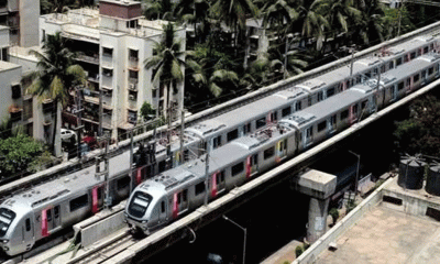
Mumbai Local Train Update: Central Railway’s New Timetable Comes Into Effect; Check Full List Of Revised Timings & Stations
-
 Maharashtra1 year ago
Mumbai To Go Toll-Free Tonight! Maharashtra Govt Announces Complete Toll Waiver For Light Motor Vehicles At All 5 Entry Points Of City
-

 Maharashtra1 year ago
False photo of Imtiaz Jaleel’s rally, exposing the fooling conspiracy
-
 National News1 year ago
Ministry of Railways rolls out Special Drive 4.0 with focus on digitisation, cleanliness, inclusiveness and grievance redressal
-
 Maharashtra12 months ago
Maharashtra Elections 2024: Mumbai Metro & BEST Services Extended Till Midnight On Voting Day
-

 National News1 year ago
J&K: 4 Jawans Killed, 28 Injured After Bus Carrying BSF Personnel For Poll Duty Falls Into Gorge In Budgam; Terrifying Visuals Surface
-

 Crime1 year ago
Baba Siddique Murder: Mumbai Police Unable To Get Lawrence Bishnoi Custody Due To Home Ministry Order, Says Report